Yangon (Rangoon) Map 1912
Published on December 17th, 2008

| Last updated January 14th, 2009 | 185 page views so far |

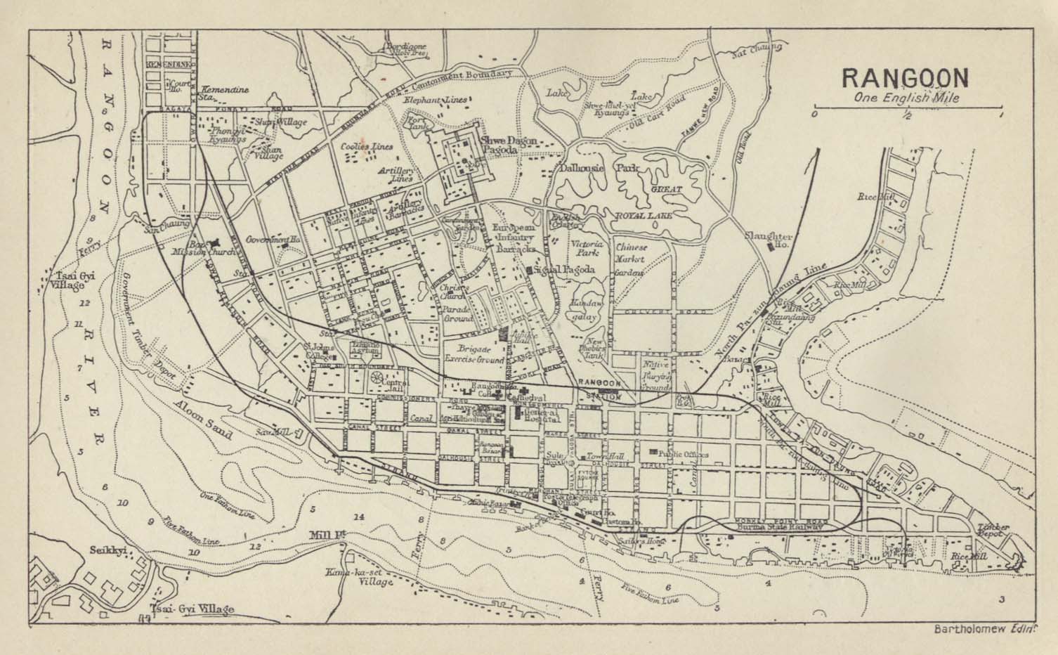
If you are looking for the ancient map of Yangon (Rangoon) during the colonial period, either for the research or academic purpose, or just for curiosity, here is the map of Yangon (Rangoon) in 1912. You can see that colonial Rangoon was quite small compared to current day Yangon. Nevertheless, the city plan remains essentially the same today as 100 years ago. The downtown area plan of current day Rangoon obviously was already in place in 1912 according to this map.
Related posts:
- Yangon (Rangoon) Map 1914
- Travel Guide to Yangon (Rangoon) – Pagodas
- Buses in Yangon (Rangoon)
- Living in Yangon (Rangoon) as an expatriate
- Money Exchange in Yangon (Rangoon)
Link to us
Do you find this article useful? Perhaps you might want to let others find this article also. If you are running a blog/website, you might want to link to our website. Just copy and paste the following code into your blog. Your link is really appreciated.
<a href="http://www.myanmar2day.com/">Myanmar Today</a>
Recent Comments